Starting in the morning from the Rinjani Trek Centre in the village, the climb to Plawangan II at 2,638 m will take about 8 hr via POSI (1,300 m), POSII (1,500 m) and POSIII (1,800 m). Starting altitude is1100 m, so there are no humid conditions to deal with. First half or more of the trek is literally a breeze. The trek through savannah grassland is windy and easygoing, with gentle ups and downs, and the only obstacle to look out for are the “cow pats” deposited by the villagers’ cows along the way. Rolling hills and amazing scenery help to ease the tiredness, unlike the enclosed tropical rainforest of Senaru route. From POS 2 to POS 3, the climb is still manageable. The challenge for Sembalun route is from POS 3 to POS Extra, as the uphill gradient can be 50 degrees at times. Young children will find this section challenging as some steps are set quite far apart. Cooler weather up here may give the impression that the body does not need fluids, but do drink more to prevent altitude sickness setting in. Strangely, there is a guy selling cold drinks (Pocari sweat, Coke etc) here at the campsite at exorbitant prices (40000 Rp per drink) for those who crave it. Overnight at the campsite here and go for the summit starting at 3AM the next day. You need to be well rested as this is a stiff task – the final climb is nearly 1,100 m on difficult ground.
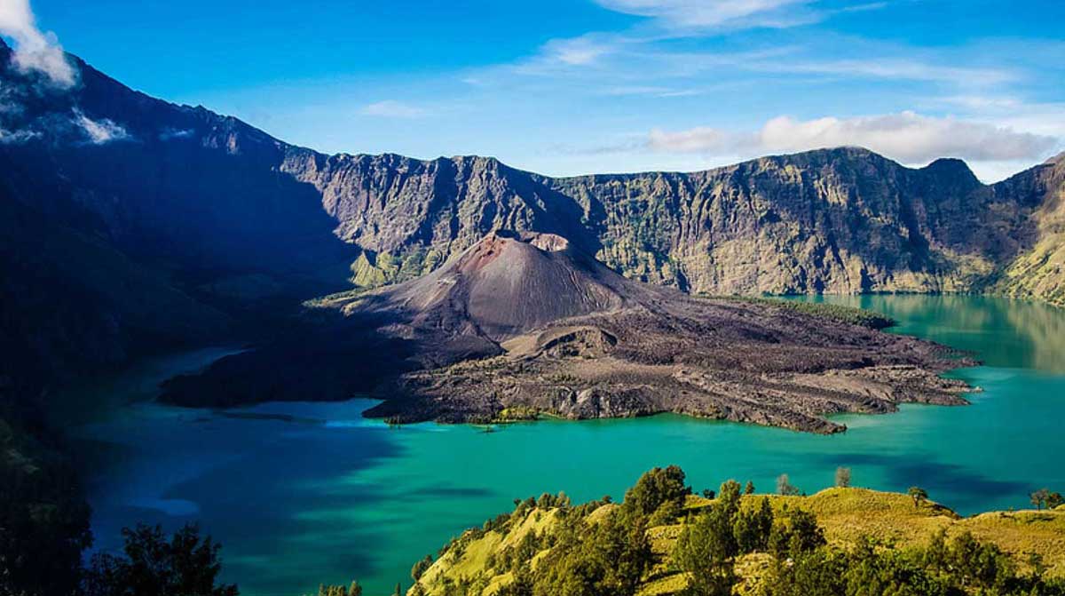
Sembalun Lawang is set in an ancient and fertile caldera to the east of Mt. Rinjani, the preferred access route for summiteers. The rich soil produces high quality market garden crops, including the famous garlic and rice, staple of local farmers. Seismic activity is monitored daily at the government Rinjani Volcanology Centre.
The beautiful valley of Sembalun is also known for its hill walks, recently restored traditional village, active cultural performers and local weavers.
Some home stay (losmen) accommodation is available and trek services are based at the Park’s Rinjani Information Centre. Also enquire about the local walks: the Sembalun Lawang Village Walk, to experience the scenic beauty of the village or/and the Sembalun Wildflowers Walk, a two day one night hike to see the wildflowers at Propok in Gunung Rinjani National Park.
Sembalun Area
Sembalun is divided into two villages, namely Sembalun Lawang village and Sembalun Bumbung village which are 2 km apart. The two villages are well known traditional villages have a lot of history about the Sasak people. The area looks like a dry lake, transformed into a fertile land.
Sembalun as a tourism object is already well known inside and outside the country, because from this village climbers begin the hike to the top of Mount Rinjani to enjoy the beautiful sights. At Sembalun Lawang village there is a Beleq village where one can see the artefacts of traditional houses of the local Sembalun people, the grave of Majapahit or Gajah Mada and the traditional Tandang Mendet dance of the local people.
There is a big statue in Lawang of two big ‘onions’ indicating that this area was once one of the biggest producers of onion (bawang bombai) / garlic (bawang putih) / shallot (bawang merah) in Indonesia.
In Lawang is the Rinjani Information Centre. Nearby is the Rinjani Volcanology Centre. To the west, there is a major greenhouse project using soil and hydroponics techniques there, producing vegetables for local and export markets.
Sapit
Just off the way to Sembalun, Sapit is a combination of beautiful sights, agriculture, and mountains. The traditional society in this village ploughs agricultural land and garden with their traditional ways. There is accommodation there with brilliant views across the rice fields to the coast and Sumbawa Island. You can take walks to various interesting places.
kampung bet
kampungbet
kampungbet
kampungbet
kampungbet
kampungbet
kampungbet
kampungbet
kampungbet
kampungbet
kampungbet
kampungbet
kampungbet
link gacor
kampungbet
kampungbet
kampungbet
kampungbet
kampungbet