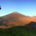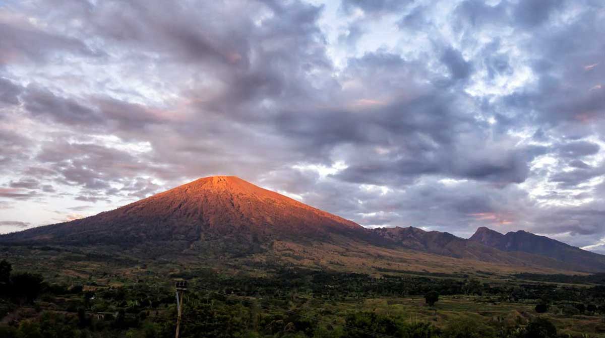


At 3,726 m, Rinjani is the second highest volcano in Indonesia, second only to Mount Kerinci on Sumatra, and it dominates the landscape of the relatively small island of Lombok.
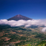
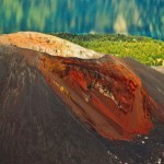
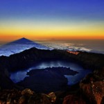
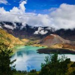
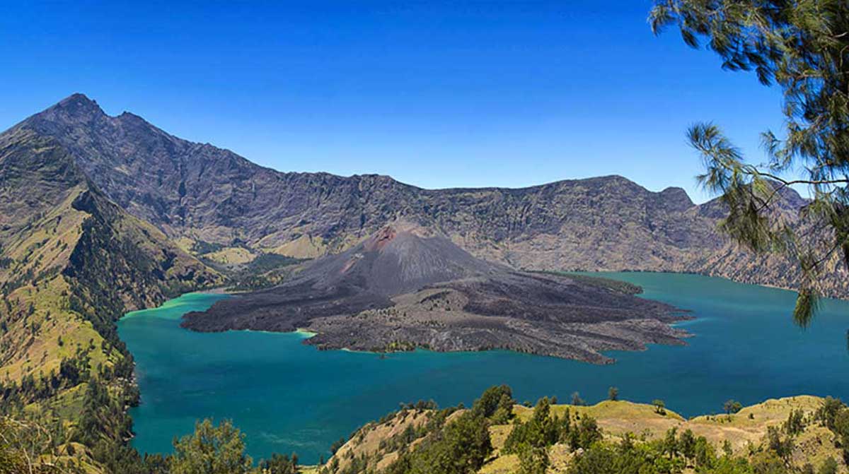
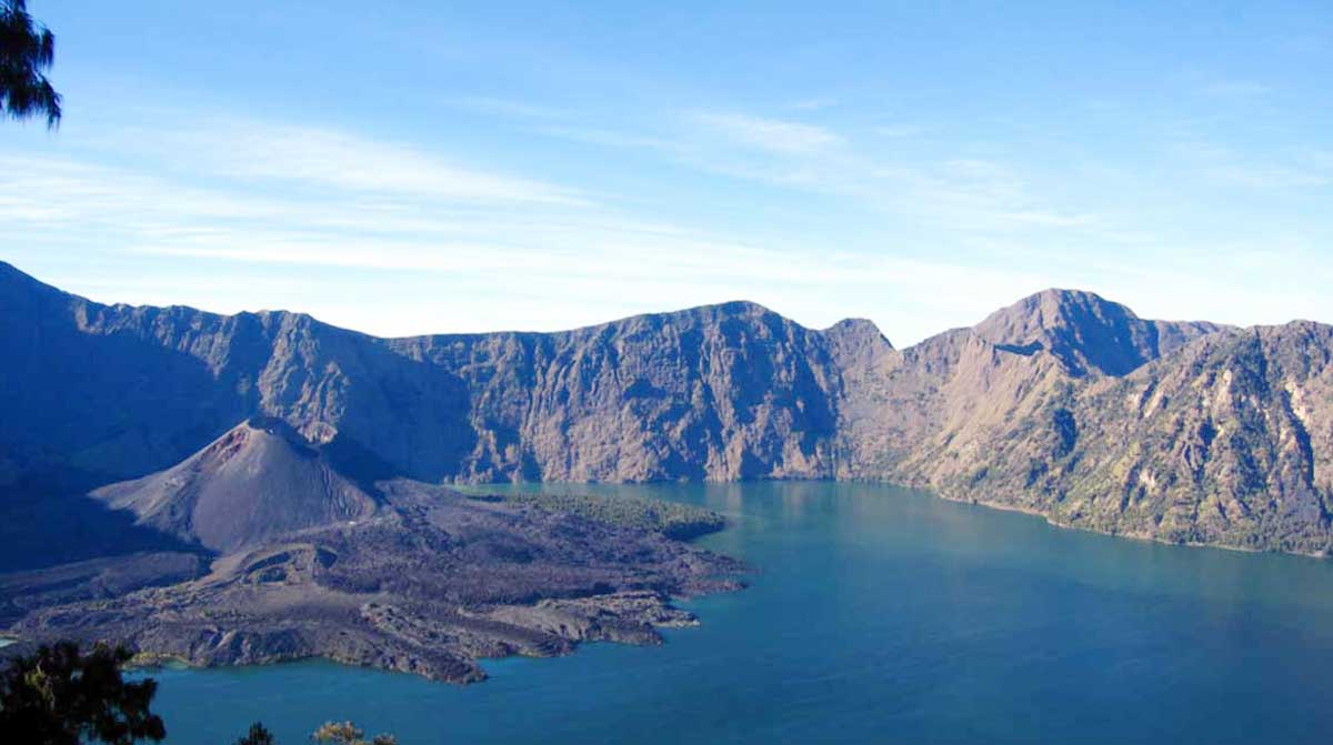
Within its huge 50 km² caldera sits the crater lake Segara Anak (Child of the Sea). Eruptions within the caldera have formed a new small cone called appropriately enough, Gunung Baru (New Mountain). Segara Anak has a natural hot spring.
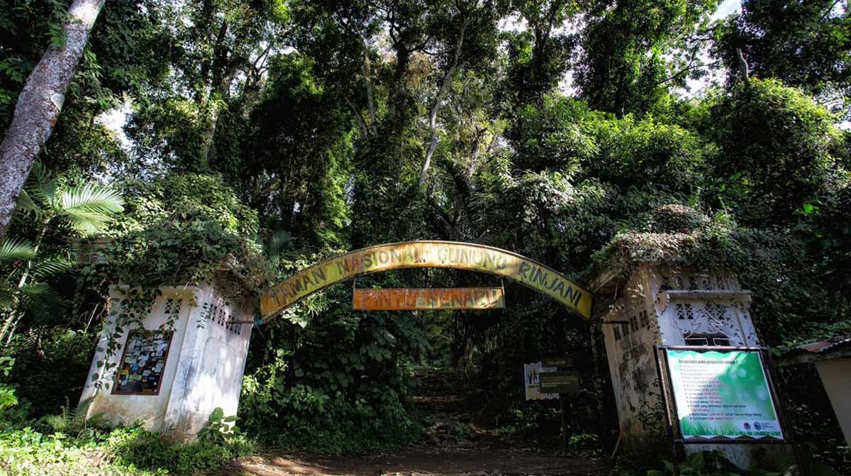
The mountain and its satellites form the Mount Rinjani National Park (Taman Nasional Gunung Rinjani) – officially 41,000 hectares within the park boundaries and a further 66,000 hectares of protected forest outside.
In 2008, the Indonesian government proposed to UNESCO that Mount Rinjani be one of the world’s official geoparks. If this was approved by UNESCO, Mount Rinjani would become the first such geological park in Indonesia.
History
The oldest recorded historical eruption was in 1847. Previous to that this was a very remote region indeed, hence the lack of records.
There was a spate of activity from 1994 to 1995 which resulted in the further growth of the crater cone Gunung Baru, since renamed Gunung Barujari (Finger Mountain).
On 27 April 2009 Gunung Barujari became active again with that activity continuing through to May 2009. The summit ascent routes were closed at that time as the eruptions intensified with plumes of smoke and ash as high as 8,000 m. A Volcanic Explosivity Index (VEI):2 rating was issued for the activity between May and December 2009. The ascent routes re-opened on September 14th 2009 but hiking routes down into the crater lake were still deemed unsafe and remained closed.
In February 2010 observers at the Gunung Rinjani Observation Post detected a smoke plume that rose 100 m from the volcano. The activity in early 2010 is centred about Gunung Barujari. On May 1st 2010 a column of smoke was again observed rising from Rinjani issuing eruptions 1,300-1,600 metres tall with thick brown color and strong pressure. On May 5th 2010 a possible ash plume rose to an altitude of 5.5 km (18,000 ft) and drifted 150 km NW. Accordingly the Center of Volcanology and Geological Hazard Mitigation advised that intermittent activity could produce ash plumes to 1,500 m (5,000 ft) above the caldera. In light of this The Volcanic Explosivity Index Alert Level was raised to 2 with a recommendation that there be no activity within a radius of 4 km from the eruption at Gunung Barujari.
Recent activity
Rinjani erupted three further times on 23 May 2010 with activity continuing until 24 May 2010. According to the volcano’s official monitoring agency, ash from Mount Barujari was reported as rising up to 2 km into the atmosphere and damaged crops. Lava flowed into the caldera lake, pushing its temperature up from 21°C to 35°C, while smoke spread 12 km. The volcano did not directly threaten villagers during any of the eruptive activity in early 2010 however access to some sections of the Mountain was officially closed or restricted at some times.
LANDSCAPES
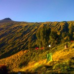
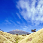
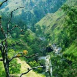
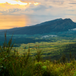
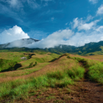
The lower and mid levels of the mountain are quite heavily forested. Above the tree line though the slopes are barren and rugged scree slopes and volcanic rock. The views of the crater lake are quite breath-taking from the caldera rim, as is the sunrise. From the absolute peak you can see Bali to the west and Sumbawa to the east.
Flora and fauna
The lower and middle elevation slopes are densely forested with typical tropical species, including species which occupy the Wallacea transitional region between the SE Asian and Australasian flora. Fig trees are especially apparent in the lower forests, as are the giant Syzigium Jambu, with the gnarled and epiphyte-hung Engelhardia Bak Bakan becoming prominent in the higher elevations. Casuarina woodland (cemara) takes over higher up and eventually these give way to an alpine flora above the treeline.
Lombok is East of the Wallace Line and some bird species with Australasian affinities are therefore apparent. These include honeyeaters, cockatoos and green hanging parrots, in addition to species whose heartland is to the West including tits, weavers and tailor-birds. Bird life can be difficult to observe here due to the density of the forest, though if you have patience and are practised at mimicry many species can be tempted out from cover – if you have the time to spare and the forebearance of your trekking partners.
The familiar long-tailed grey macaque (the Bali temple monkey) is common right up to the crater rim. Of much more interest is the rare ebony leaf monkey which inhabits these forests and whose soft hooting contact call often provides a soothing backdrop to the birdsong. Rusa deer and muntjacs are more often heard than seen.
HOW TO GET IN:
Most visitors arrive via the village of Senaru (600 m), on the northern side of the mountain and thus closer to the main resort areas of the west coast including Senggigi. The other possible entry point is Sembalun Lawang (1,150 m), on the eastern side, which is closer to the summit.
Both villages are accessed from the main north coast road.
FEES/PERMITS/ENTRANCE FEES/TICKETS
Entry to the park costs Rp 150,000 per person. This fee is split up as follows: 13% to the national park authority, 62% to the Rinjani ecotourism trekking program (which is a shame given that the path are full of detritus thrown away by the guides and porters) and 25% for trek route maintenance etc.
WHAT TO SEE IN THE PARK
Segara Anak, the crater lake and Aik Kalak hot springs, at the crater rim
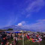
The Mulang Pakelem. This annual Hindu ceremony at the crater lake dates from the 18th century invasion of Lombok by Balinese from the kingdom of Karangasem and attracts hundreds of participants. The lake is sacred to Hindus and the sight of hundreds of white clad Hindu pilgrims sitting and praying here is a wonderfully uplifting experience.
Gua Susu (Susu Cave). One of the three famous caves (Gua Susu, Gua Payung, dan Gua Manik) at Rinjani
CLIMBING MOUNT RINJANI
The Segara Anak crater lake of Mount Rinjani. The obvious new cone is Gunung Baru.
The basics
At 3,726 m, Rinjani is the second highest volcano in Indonesia after Sumatra’s Gunung Kerinci. It is very climbable by visitors with a high level of physical fitness. Critical is to understand and respect this great mountain: sadly, visitors have died here through failing to follow sensible procedures and make all necessary preparations.
Few actually make the very strenuous effort required to reach the actual summit but instead stop at the crater rim (approx 2,700 m) where the views of the crater lake are mind blowing. To make the extra 1,000 m ascent to the very top requires a considerably higher level of fitness, not to mention strength of spirit and sense of adventure.
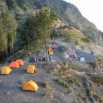
Typically, a trek to the crater rim involves two days and one night on the mountain. The longer ascent to the summit can be done with just one night’s camping but is often part of a longer trek of 3-4 days and two or three nights.
The current park entrance fee is Rp 150,000. Of this 13% is allocated to the Gunung Rinjani National Park, 62% to the Rinjani Trek Ecotourism Program and 25% to support the Rinjani Trek operation and maintenance program.
Don’t try to go it alone
An organised trek is by far the easiest, safest and most popular option but it is also quite possible to make all of your own arrangements and just hire equipment from one of the trekking centres on the mountain. Rinjani Park regulations stipulate the use of a certified guide so the people at the centre at the start of the hike are not happy to let you climb Rinjani without. With a lot of patience and explanations you can sign a paper wich says that you are responsible for yourself and not the organisation. You will still pay the entrance fee, but it is by far the cheapest option to walk by yourself.
The mountains Licensed Guide Association (HPI) issues certification to the Rinjani guides and porters but it should be understood that the certification standards and required training are no where near as rigorous as would be expected in many other countries. Serious accidents including fatalities do occur on Rinjani treks when led by these accredited guides.
Proper sturdy climbing/hiking boots are a plus but not neccesary, but a must is a substantial waterproof, windproof jacket, and a head lamp. If you are going to the top, use of poles (walking sticks) for getting through the scree (loose rock) at the top are also highly recommended. By 2,000 m, you will feel like you are not in the tropics any more as rising wet, hot air loses its temperature and may fall as rain. If inappropriate clothing becomes wet difficulties will set in as air temperatures towards the summit are as low as 4⁰C, often with a significant extra wind chill factor. You must prepare accordingly.